Take a look at the radar image taken from a few minute ago. See that blob of heavy rain south of Fairfield? Look at any Sacramento radar image when it’s raining somewhere in the Central Valley and this spot will always be raining heavily.
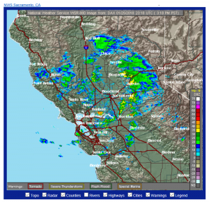
What’s up with that? Is it local rainfall enhancement from Grizzly Bay plus some orographic enhancement? Luck? Government conspiracy? Alien activity? Let’s take a look at the location from a satellite.
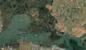
OK, looks like maybe we have a transition from nice, green state park land to browner farm land near the location of the “rain blob”. So maybe there is some kind of surface-type-transition thing going on. Let’s zoom in.
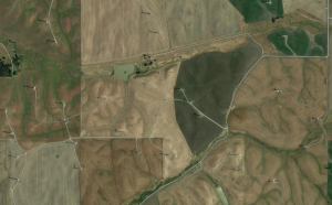
The region has some brown fields and some green fields (some “fair fields” one might say?) and some odd veining. What’s causing that? Let’s zoom in again.
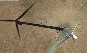
Oh, they’re wind mills. Are windmills secretly making it rain? Well, maybe, but probably not. What happening here is that the radars are seeing the windmills. Normally when a weather radar sees a very tall solid object, like a mountain, sticking up into the air it can filter out that reflection 1) because the mountain has zero velocity and 2) because a mountain has always been there. But radars can get tricked by windmills. They look like really big raindrops!